Limlahapun, P.
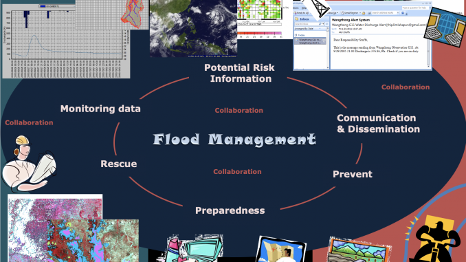
Information is one of the important key elements to predict and evacuate prior to an emergency; to control during the phase of an emergency and/or to recover during the post emergency. In the other words, limited flood disaster information causes insufficient justification for public to identify disaster affected areas. Accordingly, there is a need to improve flood-forecasting structure. Presently, there are numerous of flood monitoring and warning system. Yet, the means of integrating and processing data from reliable sources data as well as satellite images at once is rare. Therefore, this research comprised of two core components. Firstly, paper integrates the flood forecasting model with mechanism to enhance meteorological and hydrological data retrieval. It aims to improve flood monitoring, information distribution and early warning system. The spatial web based system is established to facilitate public awareness by allocating information in timely manner without cumbersome software installation. The research takes the approach of analyzing changes in rainfall and discharge distribution on the basin, over the watershed. Thus, the new system provides better visualization of the areas where flood might occur. In addition, the new flood
forecasting system operates more efficiently, as one stop service provider, by gathering disaster information from geospatial data catalog web services. As a result, spatial information is shared among different sources for the benefit of users. Secondly, it examines a satellite images processing system with a mechanism for detecting and responding to flood monitoring and warning. The interoperable handling system is established in order to freely
access the inundated areas with no defensive barrier by the software operability limitations. The ultimate goal of this effort is to bring awareness of the potentially catastrophic occurrence
that can be pre-detected and prevented altogether. The development of the algorithm to extract the inundated areas and convey urgent messages during the time of crisis are performed on a user-friendly web based interface. A careful examination of various locations on LANDSAT images yields promising results. Although the size of images is limited by the available bandwidth of the web based application, processing at 4000*4000*3 bands per image takes approximately 3 minutes. This is a significant improvement over currently available methods for inundated detection systems. Additional benefits include software operation cost saving, and also reducing in operational expenses and time. Furthermore, it does not require technical expertise to predict the rise of flood disasters.
- Limlahapun, P. and Fukui, H. (2010), “Flood Monitoring and Early Warning System: Integrating Object Extraction Tool on Web-based”, SICE Journal of Control, Measurement, and System Integration, Vol. 3, No.6, pp. 476-483.
- Limlahapun, P. and Fukui, H. (2011), “Soil erosion risk assessment using spatial analysis and TRMM daily rainfall, KEIO SFC JOURNAL, Vol.11 No.1, pp. 45-62.