This event was held as a year-end briefing session for activities of the M-NEX project in the area. Residents, companies and administration, even high school students met together at WISE Living Lab in Tama-Plaza, a garden city built in the 1960s during a period of expansion in Tokyo.
The event was started by an opening address from Prof. Wanglin Yan who is a Professor of Keio University Faculty of Environmental Information and project investigator of M-NEX. Firstly, he explained the activities of M-NEX project for the year and described the bigger picture. “By looking at this area carefully, we can find potential for the region as well. Today, I would like everyone to think about Tama-Plaza, and find ways to build its potential.”
Mr. Nakayama, a student in Yan lab, built on this by showing the outcome of his current research, tentatively called “Redesigning the Future Urban Life from the point of view of Food Accessibility”. Participants offered a number of comments when he asked them to describe the “value of food”. The choice of which grocery store and how it matches the “wealth” of each person was discussed, with data showing there was not so much importance placed on one place over another as far as cost was concerned. Then, from the participants, a voice was heard saying, “It is interesting to see our choices reflected in the data”.
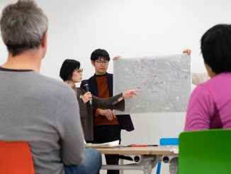
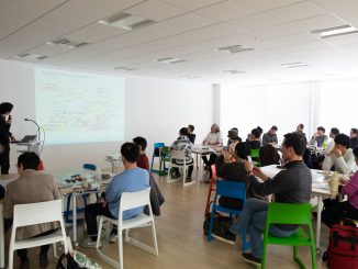
Following this presentation participants were divided into three tables under the chairmanship of Prof.Yan and a three-part workshop began. In the first part, three table sized maps showing different aspects of the local food environment were placed and the participants rotated from one table to the next in order to discuss and share their knowledge. “The current situation” was set as a common theme, and participants gave opinions on each table as they moved from map to map. This method of working was a positive way to maintain interest in a group of people not accustomed to doing workshops.

At the table where the map of “daytime population / nighttime population” was placed, attention quickly focused on “Buildings where the population increased in the day” within residential areas. “Is it a hospital or private shop?” “If we built on these hot spots and turned them into food bases, could we cover the area widely?” The discussion focused on the surprising potential of the area. At the table where a map indicating “store locations” was placed, the movement of shops was a topic. “This Living Lab that we are talking about right now was once a drug store.” “There used to be a fish store, a liquor store, a butcher and a grocery store in the past but now there is only a liquor store.” We overlapped age with the grocery stores that gradually faded away and recognized local issues. At the table on which the map of “land use” was placed, we discussed the presence of farmland on the planned residential area, the use of agricultural land on rooftops, and how the general residents of remaining farmland should use it. We were also bothered by the essential question “What are the merits of having farmland in residential areas?”
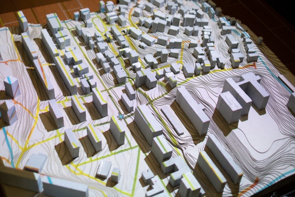
In the second part of the workshop, “The social needs of the community” was the theme. Three tables were organized around “society”, “economy” and “environment”, respectively. While discussing “society”, discussion was carried out alongside a 3d model that visualized accessibility based on age in the area. As a result, we heard that “Elderly people can not go out, but do not want to stay at home,” and the possibility of mobile shops was debated.
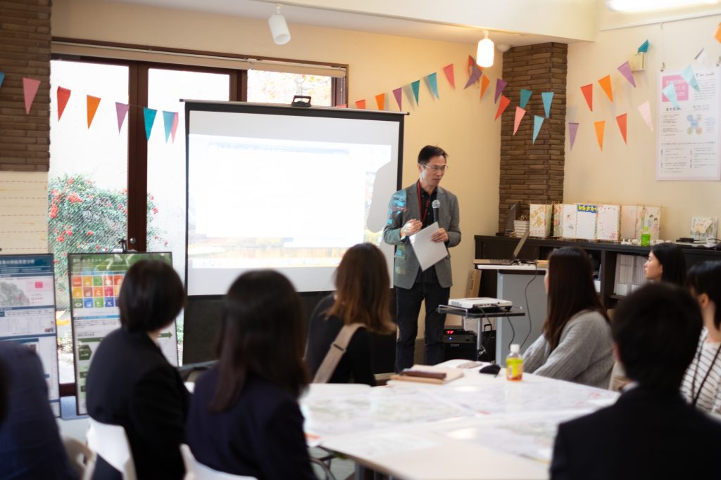
The projection system was able to show scientific data in an easy-to-understand manner and worked as a lubricant for discussion. We would like to advance visualization of scientific data for residents going forward. At the “Economy” table, student facilitators explained the difference in sales per unit area of convenience stores and supermarkets. Regarding the possibilities of small business to solve regional problems, many opinions were offered bout the role of elderly “retired” workers in the community. From the “Environment” table, there was a discussion focusing on food mileage. Various initiatives are taking place in the community, such as convenience stores in areas that introduce bicycle recycling and social experiment efforts by Tokyu Corporation. Each participant considered ways to improve their environmental contribution.
At the end of the workshop, we advanced a design draft for each table, connecting the potentials of the region and solving the problems of the food environment. At the end of the discussion a presentation was given by a representatives from each table. Proposals included themes such as “Building a community within a 5 minutes walk”, “shared kitchens”, “support system of stakeholders for residents”. A regional community cafe was proposed as a local kitchen, with the idea being that it would act as a place to connect people through food and build empathy.

Finally, we heard the opinions of the participants on the workshop. Among them, from the comments of the local residents, “The university carefully investigated, it gradually became visible, and we are very much looking forward to how it will be shaped from now” and we were able to hear what is expected of M-NEX going forward.
This event was closed at that point. In the last presentation, every design proposal showed the expectrion for the sustainable development of the community. In Tama-Plaza community is likely to be a key word. For M-NEX, as we cooperate with local community cafes and similar outlets, challenges that include connecting and connecting with communities from the approach to the food environment are likely to be central.